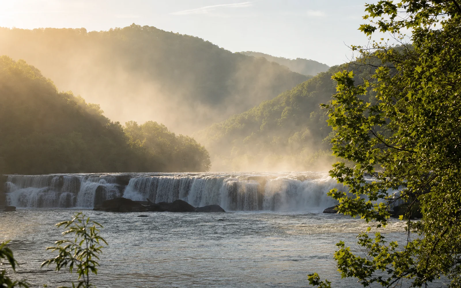
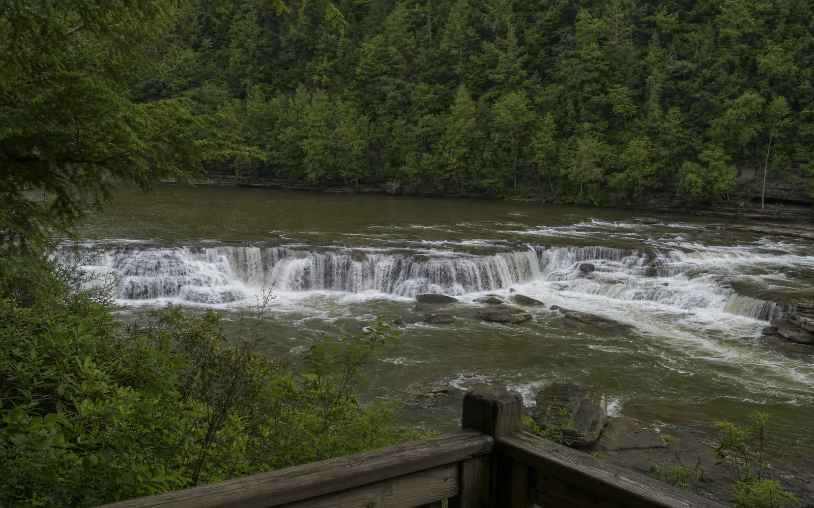
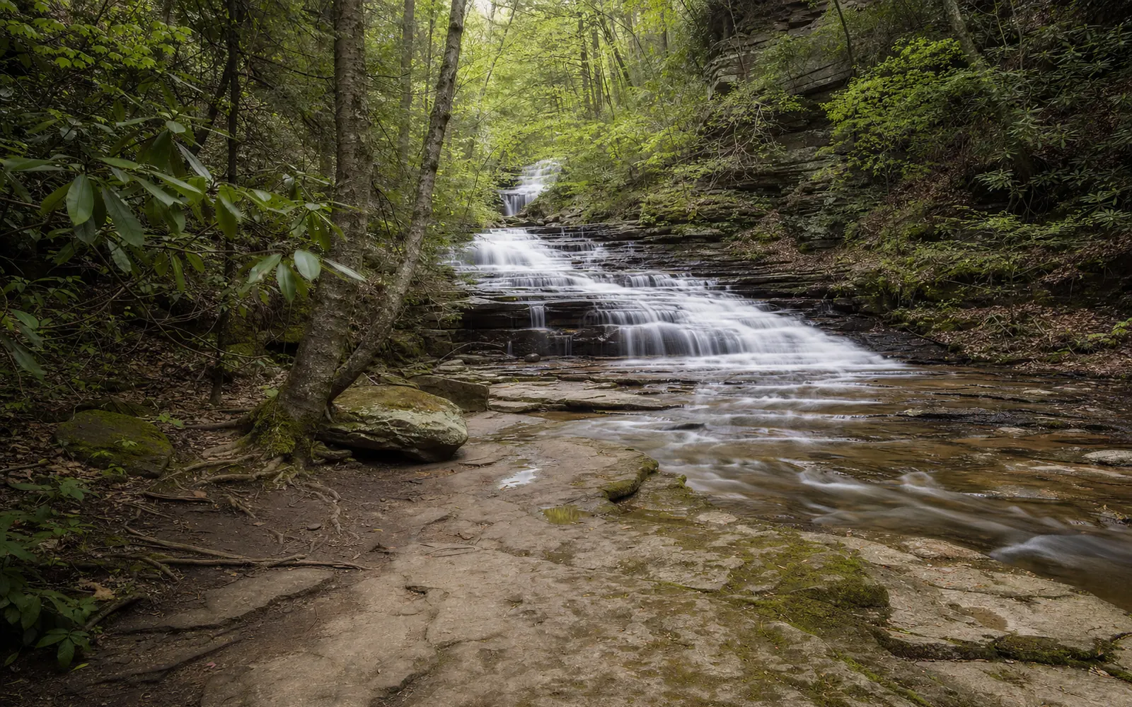
The New River Gorge hides waterfalls in every side creek, and the Park Service's waterfall tour strings eight of the best into one route: Kanawha, Cathedral, Kaymoor Mine Falls at Wolf Creek, Butcher Branch, Dunloup, Glade Creek, Big Branch and Sandstone. None charges admission, and four barely need a walk (Kanawha, Cathedral, Dunloup and the Sandstone boardwalk). The tallest is Cathedral Falls, a 60-foot drop right off U.S. 60; the biggest is Sandstone Falls, which spills across the entire 1,500-foot width of the New River.
The tour runs roughly north to south, starting just outside the park at Kanawha Falls. Here's the lineup, followed by the falls sorted by how much walking you'd like to do.
The eight falls at a glance
Eight waterfalls in and near the New River Gorge compared by height, access, effort and notes | Stop | Waterfall | Height | How you reach it | Effort | Good to know |
| 1 | Kanawha Falls | About 15 ft (some sources say up to 24) | Dirt lot on U.S. 60, 0.75 mi past Gauley Bridge | From the road | Seen from the road; picnic tables nearby |
| 2 | Cathedral Falls | 60 ft | Small lot on U.S. 60; paved path to a bridge | From the road | Short dirt trail "not accessible and may be slippery" |
| 3 | Kaymoor Mine Falls at Wolf Creek Fayette Station Road closed after the August floods; check before you go | Small, mine-fed | 0.1 mi from the bridge on the Kaymoor Trail, off Fayette Station Road | Short walk | Not accessible; steep drop-offs |
| 4 | Butcher Branch Falls | Tiered cascades | Butcher Branch Trail from the Kaymoor Top trailhead; 0.45 mi | Short walk | Not accessible; "rainfall dependent" |
| 5 | Dunloup Falls | 20 ft | Unmarked pullout with a large rock, Thurmond Road, 4.3 mi from WV 61 | From the road | No vehicles over 25 ft or trailers |
| 6 | Glade Creek Falls Glade Creek Road closed past Grandview Sandbar since the August floods | Small falls and pools | About 1 mi on the Glade Creek Trail from the campground trailhead | Hike | First 1/4 mi of trail accessible; the falls are not |
| 7 | Big Branch Falls | Nearly 30 ft | 0.7 mi from the Big Branch trailhead on New River Road, across from Brooks Falls | Hike | Not accessible; loop rated strenuous |
| 8 | Sandstone Falls Eastbound I-64 Exit 139 ramp closed through late October | Drops of 10 to 25 ft, 1,500 ft across | Nine miles along River Road (WV 26) from the Hinton bridge; boardwalk about 1/4 mi | Short walk | Boardwalk "compatible with certain mobility aids" |
Waterfalls you can see without a hike
Cathedral Falls and Kanawha Falls, on U.S. 60
These two are the closest to Fayetteville and the least work. At Cathedral Falls, Cane Creek drops 60 feet over a ledge of shale and sandstone, "one of the highest waterfalls in West Virginia," the Park Service says. A small lot on U.S. 60 near Gauley Bridge leads to a paved path and a footbridge, and a short dirt trail goes closer (it's slippery and not accessible). Honestly, the bridge may be the better seat: a Blue Ridge Country writer likes how it takes in the upper tiers and lower cascades together. The lot is small and busy, so come early morning or evening.
Kanawha Falls is a whole different animal: a sandstone ledge running the full width of the Kanawha River, about a mile below where the New and the Gauley meet, with a low dam above feeding a hydropower plant. You can see it straight from a dirt lot 0.75 mile past Gauley Bridge, there are picnic tables nearby, and the Park Service says it's "enjoyable to see at any water level." It stands about 15 feet at its highest point by the park's measure (other sources say 20 feet or more), tall enough that fish can't get past it.
Cathedral Falls is 14.3 miles from Canyon Rim Visitor Center by U.S. 19 north and U.S. 60 west, roughly 21 minutes from downtown Fayetteville, and Kanawha Falls is about five minutes beyond. Both are stops on the Midland Trail day trip.
Dunloup Falls, practically a drive-by
On Thurmond Road, 4.3 miles from WV 61, the creek drops 20 feet off a sandstone shelf, and if you're lucky a coal train will rumble along the tracks just above it. There's no sign, just a large rock at an unmarked pullout, and the park doesn't recommend vehicles over 25 feet or trailers. It pairs perfectly with a wander around Thurmond.
Short walks: Sandstone, Kaymoor Mine and Butcher Branch
Sandstone Falls is the one to build a day around. The river splits around a chain of islands and drops 10 to 25 feet across 1,500 feet of ledges, and about a quarter mile of boardwalk carries you over two bridges to island viewing decks right beside the roar. The boardwalk works with some mobility aids, and the half-mile Island Loop Trail begins and ends on it. Mornings and weekdays are quietest.
The catch is the drive. The falls sit about nine miles along River Road (WV 26) from the west end of the WV 20 bridge in Hinton, on a road the park calls "single lane in places," and the unpaved lot closes a half hour after sunset. Don't confuse the falls with Sandstone Visitor Center at I-64 Exit 139, which is 22.5 road miles away. Through late October, the eastbound Exit 139 ramp is closed, WVVA reported, with a detour via Exit 143. Hinton is a bit over an hour from Fayetteville. Short on time? The Sandstone Falls Overlook on WV 20 looks down from 600 feet above the river, a tenth of a mile along a gravel walkway. The Hinton and Sandstone day trip has the full route.
Closer to town, Butcher Branch Falls tumbles down tiered sandstone in a series of cascades 0.45 mile from the Kaymoor Top trailhead. It depends on rain, so skip it after a dry week. Kaymoor Mine Falls at Wolf Creek, fed by water draining from the old Kaymoor mine, is 0.1 mile from the bridge on the Kaymoor Trail off Fayette Station Road; keep well back from the steep drop-offs, and in fall and winter you may spot it from the road once the leaves are down. The upper Kaymoor Miners Trail is a separate walk with its own weekday closure.
Worth the hike: Big Branch, Glade Creek and Kates Falls
Big Branch Falls plunges nearly 30 feet down tiered sandstone in a shady ravine, 0.7 mile from its trailhead on New River Road, 3.9 miles from the Hinton bridge and right across from the Brooks Falls lot. The full loop is about two miles and rated strenuous. WV Explorer ranks it among the best waterfall hikes in the state, especially in spring; expect slippery stream crossings and steep, rocky footing.
Glade Creek Falls is really a string of small falls, cascades and pools about a mile up the Glade Creek Trail from the campground trailhead, following an old narrow-gauge railroad grade. The first quarter mile of the trail is accessible; the falls aren't. Kates Falls, off the tour, waits on a 0.2-mile spur 4.6 miles up the same trail. Skip the shorter upper trailhead: its road is only fit for high-clearance four-wheel drives.
Status as of September 22, 2026: Glade Creek Road and Glade Creek Campground closed after an August 11 mudslide, and the road was still closed past the Grandview Sandbar campground after the August 15 and 16 flash floods. No reopening had been announced as of September 22. A washout at the Kates Falls Trail junction 'may be impassable when creeks are running high,' the park warns. Check the
MetroNews report before you go.
The Glade Creek Trail page has the full route. Until the road reopens, make Big Branch your hiking waterfall.
Brooks Falls: look, but think twice before swimming
Brooks Falls isn't on the tour, but it's right across the road from the Big Branch trailhead. The "smaller sister to Sandstone Falls" is a 4-foot drop across the river's full 1,000-foot width, and it runs as a Class III rapid. The roadside park has restrooms, picnic spots and river access, plus an accessible viewing deck over the main ledge. A posted sign says it plainly: "Always wear a life jacket when wading or swimming in the shallow river access eddies."
Take that sign seriously. On July 6, 2026, a swimmer went under near Brooks Falls, and divers recovered the body the next morning, Lootpress reported. The park has no designated swim areas or beaches anywhere, and the Park Service's water-safety page notes that "Most drownings in the New River involve people who didn't plan on being in the water." Enjoy it from the deck. Wildlife and safety has the rest of the river rules.
When do the falls look their best?
Creek falls are at their fullest after a good rain, and Cathedral Falls runs noticeably thinner in dry spells. Kanawha looks fine at any level, Butcher Branch can dry up entirely, and Kaymoor Mine Falls shows from the road once the leaves drop. The river falls, Sandstone and Brooks, rise and fall with the New, which you can check live on the Thurmond gauge. And in October, every one of them comes framed in fall color.
More waterfalls farther afield
Twin Falls Resort State Park near Mullens has Marsh Fork and Black Fork Falls on a one-mile loop, though state tourism says they tend to dry up in the warmer months. The Falls of Hills Creek, in the Monongahela National Forest past Richwood, stacks three falls of 25, 45 and 63 feet along a three-quarter-mile trail; the first 1,700 feet is paved and wheelchair accessible, and the rest is stairways and boardwalk.
Mill Creek Falls, on the Hawks Nest Rail Trail near Ansted, needs a phone call first. The state park's trail page still showed the rail trail closed for repairs as of September 22, so call Hawks Nest State Park at 304-658-5212 before walking in. For fall color, geology and wildlife, see the New River Gorge nature guide.
Which waterfalls to pick for your day
Got a morning or an afternoon? Drive the Midland Trail to Cathedral and Kanawha falls: under half an hour each way, no hiking, and you get a 60-foot plunge and a river-wide ledge in one outing. Got a full day? Head south and make Sandstone Falls the main event, with Big Branch and the Brooks Falls deck along River Road on the way, allowing for the Exit 139 detour until late October. Save Glade Creek for after its road reopens, and skip Butcher Branch after a dry week. Want a mill and a cascade in one frame? Add Babcock State Park's Glade Creek Grist Mill. Fayetteville sits right between the northern and southern falls, which makes it an easy base; the map shows places to stay.