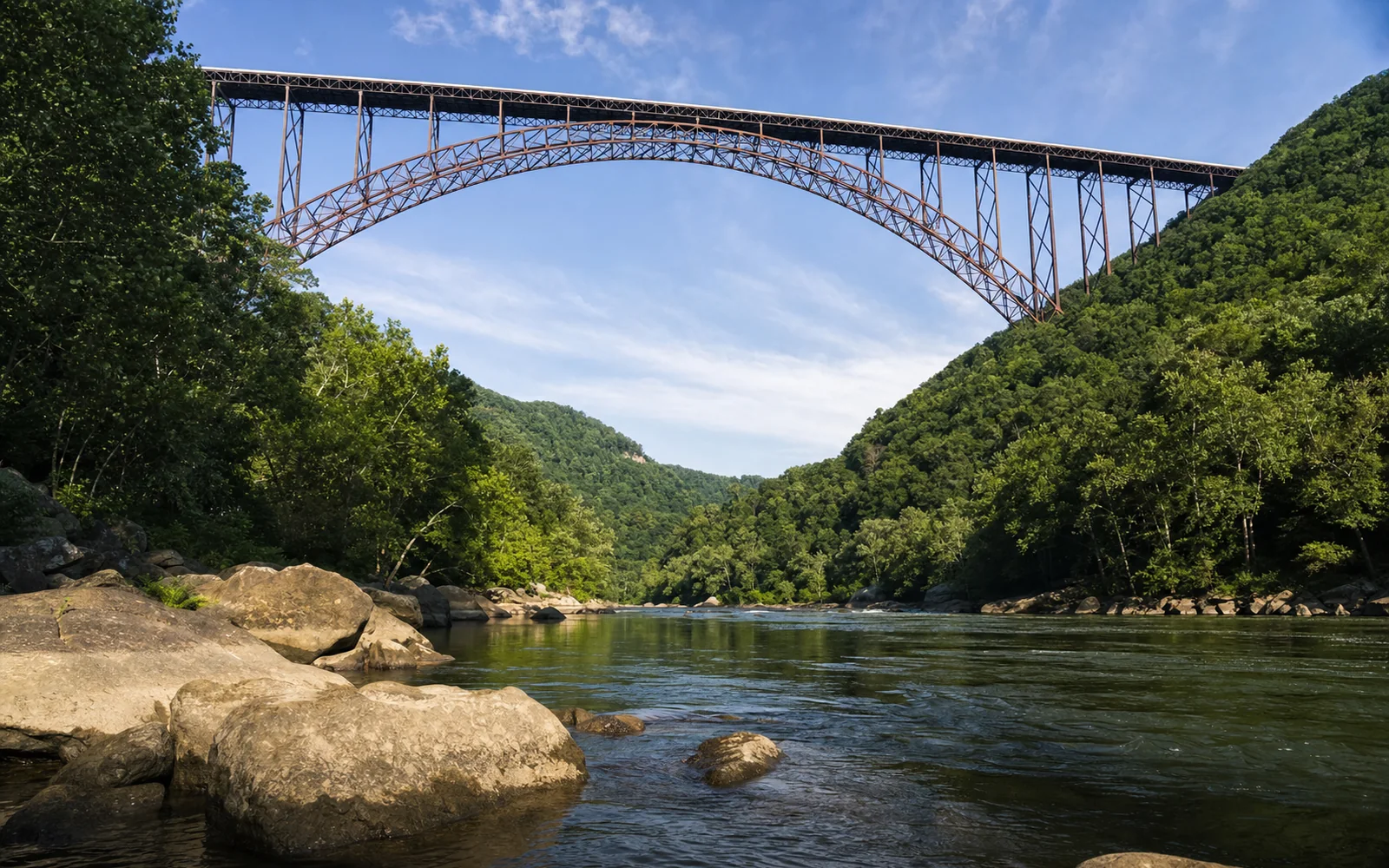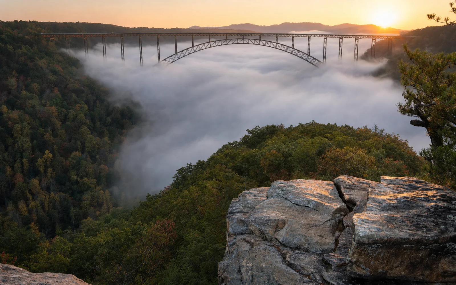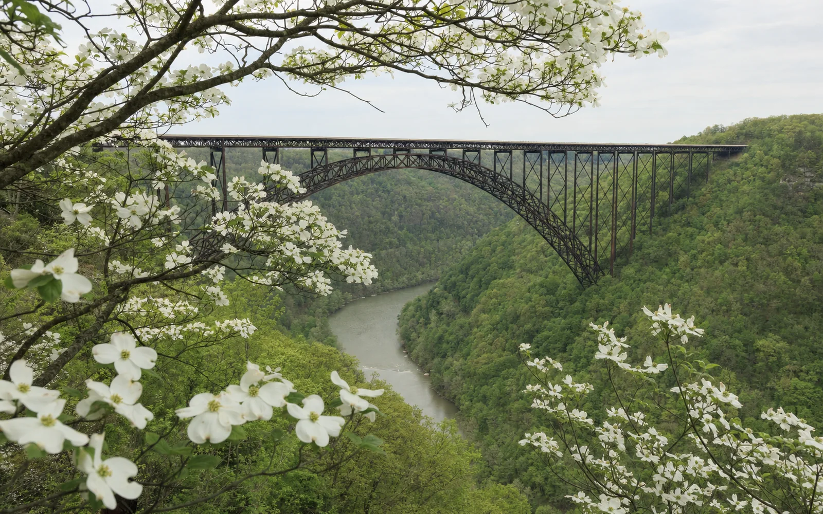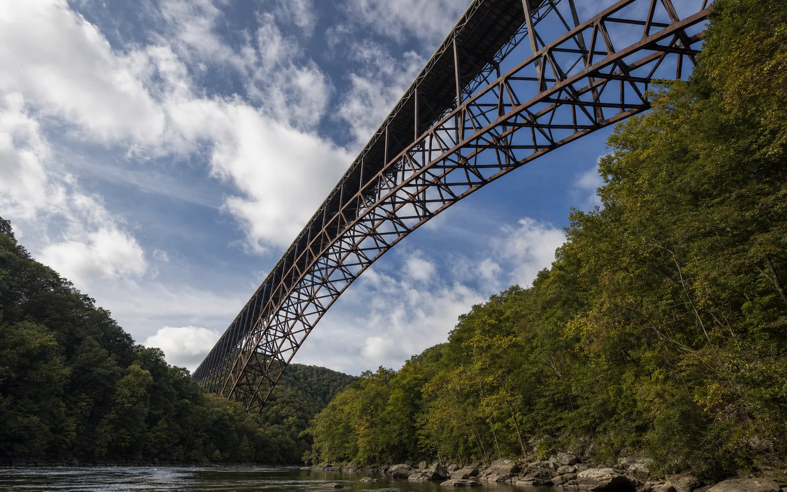
The New River Gorge Bridge throws a single steel arch 1,700 feet across the gorge and holds U.S. 19 on a deck 876 feet above the New River, right at the north edge of Fayetteville. Seeing it costs nothing. The classic free view is from the boardwalk at Canyon Rim Visitor Center, a paid catwalk tour takes you underneath the deck, and the one day you can walk across the top is Bridge Day, Saturday, October 17, 2026.
Before it opened on October 22, 1977, getting across meant winding down Fayette Station Road to the river and back up the other side, a 40-minute drive by the Park Service's count that the bridge cut to "less than a minute." That rusty color is on purpose, too. The steel is COR-TEN, a weathering steel, so the bridge never needs painting.
How tall and how long is the New River Gorge Bridge?
The deck sits 876 feet above the river and the whole bridge runs 3,030 feet end to end, according to the West Virginia Department of Transportation. Here's the rest of the spec sheet.
| Measure | Figure |
|---|---|
| Opened to traffic | October 22, 1977 |
| Total length | 3,030 feet |
| Main arch span | 1,700 feet |
| Deck above the river | 876 feet |
| Deck width, curb to curb | 69 feet 4 inches, carrying four lanes and eight-foot shoulders |
| Arch rise | 360 feet |
| Maximum sideways deflection | About 21 inches |
| Weight | About 88,000,000 pounds |
| Structural steel | 21,400 to 22,000 tons |
| Cost | About $37 million (the winning bid was $33,984,000) |
| National Register of Historic Places | Listed August 14, 2013 |
How they built it
The state hired Michael Baker Jr., Inc., of Beaver, Pennsylvania, in April 1967 to design an 11-mile piece of Corridor L, and the American Bridge Division of U.S. Steel won the construction contract on June 21, 1973. With members that heavy and a deck that high, the builders sent the steel out over the gorge on a twin cableway strung 3,500 feet between towers, trolleys moving about 195 feet per minute, as a 1978 paper by the design firm's chief structural engineer explains. The Clio history counts about 22 miles of cable.
The arch grew out from both rims starting in July 1975, and the last arch piece went in in May 1976. Deck trusses followed that November. In spring 1977 crews poured the deck and bolted on more than 6,000 linear feet of aluminum railing, and that October the bridge opened as part of Corridor L, the Appalachian highway linking I-79 near Sutton with I-64 near Beckley.
Highway workers talked of an insurance policy that projected six deaths. One worker died, in what WVDOT calls a "freak accident" on the ground: a piece of steel fell on a form for a concrete pedestal and catapulted the men standing on it.
Records and rankings
On opening day it was the longest steel arch span in the world, 48 feet longer than New Jersey's Bayonne Bridge, and it kept that title until Shanghai's Lupu Bridge opened in 2003 with an 1,815-foot arch. The Park Service still calls it the longest single-span steel arch bridge in the Western Hemisphere. For the full construction story, the Bridge Day history page and Bridge Walk's are both good reads.
Can you walk across the New River Gorge Bridge?
You can drive across at any hour for free, unless an incident or Bridge Day has shut the road. On foot, it's one day a year. The deck is a working highway, and the only public walk on top is Bridge Day, held on the third Saturday in October.
Every other day, the way onto the bridge is underneath it. Bridge Walk clips you into a full climbing harness attached to a safety cable and leads you along the catwalk 25 feet below the deck, 851 feet above the river by the operator's measure. Tours run year-round, rain or shine, take more than two hours and start at $79 per person (confirm the current price when you book). Walkers need to be at least 8 years old and 48 inches tall.
The bridge is a state highway, but the gorge beneath it is national park. New River Gorge became a national park and preserve on December 27, 2020, when the designation bill (S.2555 in the Senate, H.R.4610 in the House) was enacted inside the Consolidated Appropriations Act, 2021.
That means park rules. Under the park's compendium effective July 1, 2026, flying a drone from park lands or waters takes the superintendent's written approval, and BASE jumping "is prohibited without a permit." Bridge Day is the jumpers' day: in 2025 the organizer counted 315 of them, from 35 states and 4 countries.
Where is the best place to see the bridge?
Canyon Rim Visitor Center
Start at Canyon Rim Visitor Center, 0.1 mile off U.S. 19 just north of the bridge at 162 Visitor Center Road, Lansing, WV 25862. Type in that exact address, because the park warns that Apple Maps and Google Maps "may direct you to areas of the park that are rough in terrain and inaccessible and NOT a visitor center." It's open daily from 9:00 AM to 5:00 PM except Thanksgiving, Christmas and New Year's Day, the phone is 304-574-2115, and there's bus and RV parking.
From the building a boardwalk drops into the gorge to two observation decks. The upper one has a fully accessible ramp and, TripAdvisor reviewers say, all the view you need for a great photo. The lower deck sits 178 wooden steps down (and 178 back up) and isn't wheelchair accessible; what it buys you is a lower angle with less foreground. Worth the climb if you're after that shot, easy to skip if not.
A heads-up for this fall: from September 15, a state paving job outside the visitor center may close its U.S. 19 entrance for short stretches, the Park Service warned on September 16. If you hit it, continue to Lansing-Edmond Road, the next road north, turn right, turn right again onto Fayette Station Road, then bear right at the fork and stay right at the next intersection.
Fayette Station Road
For the view that cranks your neck back, drive underneath it. Fayette Station Road, the old way across, is now a paved scenic drive of about eight miles, mostly one way, that passes beneath the bridge three times and crosses the river on the rebuilt Tunney Hunsaker Bridge. Allow 30 to 45 minutes without long stops. From Canyon Rim, go 0.3 mile north on U.S. 19, turn right onto Lansing-Edmond Road (Truck 82) for 0.4 mile, then right at the brown sign, bearing left straight away.
To see the arch from river level, cross the Tunney Hunsaker Bridge and pull into the public lot 0.1 mile beyond, or the overflow area 0.1 mile past Wolf Creek if it's full, as the park's driving-tour brochure suggests. The road has sharp hairpins and a railroad underpass with 12 feet of clearance, so leave RVs and trailers up top. It was also closed after the August floods; read the closure note below before you go.
Long Point
For the whole arch in one side-on frame, walk to Long Point. The Long Point Trail runs 1.6 miles each way from a lot on Newton Road, off Gatewood Road on the Fayetteville side, mostly downhill on the way out with one steep section just before the point. The Park Service rates it moderate and AllTrails hikers call it easy. The lot fills early and the point stays busy, so go early.
Closures and Bridge Day: what to know before you go
Until the road is listed as open, call Canyon Rim Visitor Center at 304-574-2115 before you plan the full drive.
Bridge Day 2026 is Saturday, October 17, from 9:00 AM to 3:00 PM, the one day the public walks the deck, with U.S. 19 closed to traffic from 7:00 AM to 5:00 PM. The festival's info page has the shuttle lots and the list of what's allowed through the gate.
Don't count on parking at Canyon Rim that weekend. In 2025 the Park Service closed the grounds at 5:30 PM the Friday before and warned that vehicles left inside would be towed, WOAY reported. Watch for the 2026 notice.
Where to stay near the New River Gorge Bridge
Fayetteville sits immediately south of the bridge, though you'd never guess it from the highway. The town once asked to hang a "Welcome to Fayetteville" sign on the bridge, and the West Virginia Division of Highways said no, as the town's 2024 comprehensive plan ruefully notes. To find downtown, follow WV 16 south from U.S. 19.
Canyon Rim and Bridge Walk (57 Fayette Mine Road) both have Lansing addresses, on the north side. If the bridge is the start of a longer day, the Park Service's central driving loop around the park runs about 83 miles and takes about three hours without long stops.
For a bed, pick your side: Lansing, north of the gorge, or Fayetteville, just south. On Bridge Day weekend that choice matters, because U.S. 19 is shut and the shuttles run from separate lots on each side. The map here compares places to stay around the bridge for your dates.